"Peatlands are vital in the fight against both the causes and effects of climate change. Peatlands around the world hold twice as much carbon than the world’s forests, while offering precious habitats for vital wildlife and plant species." National Trust
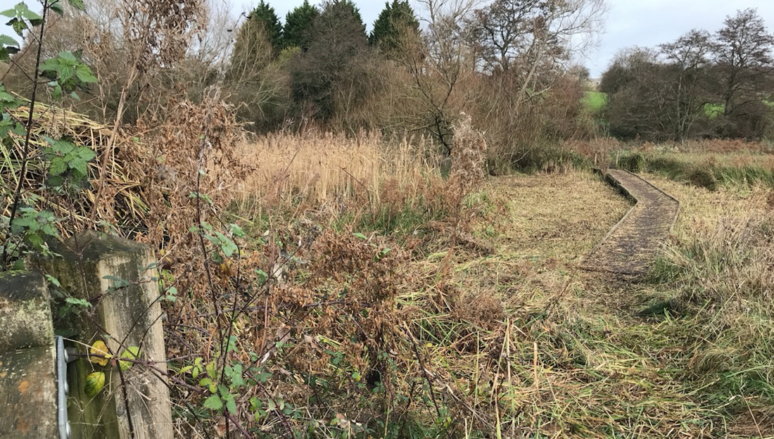
Tuckmill's boardwalk and peat marshland, Nov 2021
Tuckmill's peat marshland is part of the world's largest natural carbon store. Large amounts of carbon, fixed from the atmosphere into plant tissues through photosynthesis are locked away in peat soils. The area covered by near natural peatland worldwide stores more than all other vegetation types in the globe combined, including the world's forests. Historian and Friend of Tuckmill, Neil Maw, has started a project to establish where peat might be laid down in Tuckmill meadows and fen and how deep it is. Below are his initial findings (October 2021):
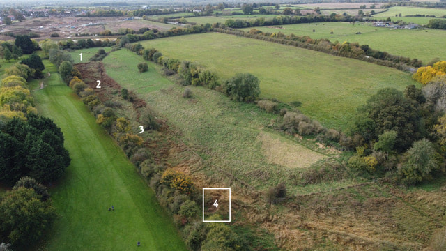
"The photo above shows the sites in Tuckmill where I took my samples, numbered 1 to 4.
"The first sample photo, top left, from site number 1 in the grass field, shows there was no sign of any peat at all, which was to be expected.
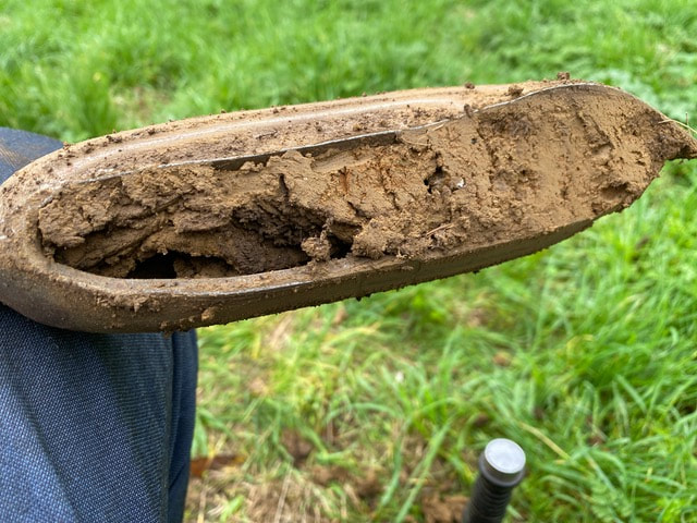
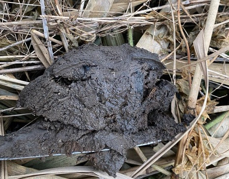
"The second sample photo, top right, comes from the area near the dam where willow herb has been pulled (site number 2). This shows there is a pocket of peat that is about 200mm in depth, indicating that the process started approximately 200 years ago.
"At site number 3 the peat formation is less - about 100mm. In the third photo, bottom left, you can clearly see the blue clay that covers the bedrock in the locale generally.
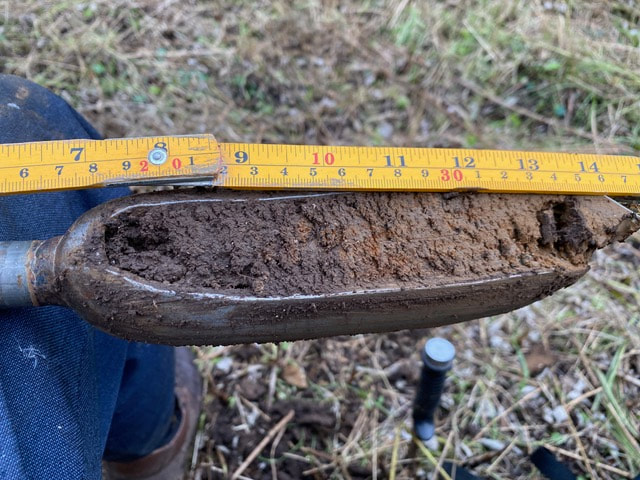
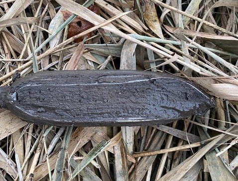
"Site number 4 is where the peat really starts. The sample shown in the fourth photo, bottom right, is from 1110mm and still going. This can be explained by understanding the formation of the valley. I carried out quite a bit of research on this in Pennyhooks Valley next door - just over the by-pass. Site number 4 is in line with the bank that slopes down from the copse. This bank was formed when melt-water from the end of the Anglian Ice-Age (approx 480,000 years ago) carved out the valley. The water flowed from right to left at the bottom of the photo. The valley with the numbers was formed by spring water over thousands of years (there is another steeper one at Pennyhooks Farm). The area at No 4 is a drop-off where the two streams of water met.
"I am now planning to investigate site number 4 further in order to determine the extent of the peat in the area to the north, and how deep in might be. Any comments and/or ideas would be appreciated."
"I am now planning to investigate site number 4 further in order to determine the extent of the peat in the area to the north, and how deep in might be. Any comments and/or ideas would be appreciated."
Neil Maw October 2021